
Field notes
How to collect farmer plot data offline for EUDR
A field guide to collecting EUDR plot geolocation where mobile coverage drops — offline geometry, consent, identity, and sync so connectivity is not the gate.
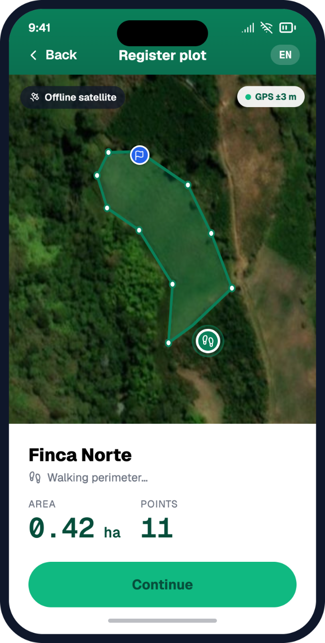
Most EUDR plot data is collected where the signal drops. Hills, plantations, village roads without coverage. If your process assumes constant mobile data, you will stall — or you will invent workarounds that break consent and quality.
This article is about offline field operations for EUDR plot data. Not generic mapping tips. The question is simple: how do you collect farmer plot geolocation when connectivity cannot be the gate?
Why offline is not optional for EUDR
The EU Deforestation Regulation asks operators for the geolocation of every plot of land that produced a relevant commodity in a shipment. For many plots that means polygons. For smaller plots, a point may be enough. Either way, someone has to stand on or walk the land.
The Commission FAQ is clear that collecting coordinates can be done with phones and GNSS devices — and that this does not require mobile network coverage, only a solid GNSS / satellite navigation signal (for example Galileo).
So the constraint is not "internet at the farm gate." The constraint is a workflow that:
- Captures plot geometry with the farmer present.
- Records consent and identity at the same moment.
- Syncs later without losing who owns which record.
- Feeds reusable packages for DDS and other programmes.
If connectivity is the gate, smallholders farthest from towers are the first left out of EU channels. That is a programme design failure, not a farmer failure.
What to capture offline (EUDR-shaped)
Keep the offline form small. Capture what you need for a reusable EUDR-ready record.
Plot geometry
- Point (under 4 ha allowed) or polygon perimeter (required over 4 ha for non-cattle commodities).
- At least six decimal digits when stored.
- One plot per polygon — do not outline a whole landscape that only partly produces the crop.
Producer and plot identity
- Enough to link geometry to a person or member ID and to the commodity.
- Production period or harvest window when known.
Consent
- Purpose: compliance and programme use (say what will be shared with buyers / authorities).
- Who may receive the data.
- How the farmer can ask for a correction.
Capture metadata
- Who collected it, when, device/app, offline flag, optional accuracy notes.
- Later corrections should be versioned, not silently overwritten without a trail.
You do not need a full audit dossier in the first visit. You need a clean, consented plot record that can sync and then be moulded.
A practical offline to sync loop
Before the visit
- Download basemaps or work offline-capable layers where available.
- Pre-assign member lists or blank IDs so collectors are not typing under stress.
- Brief collectors on one-plot-one-polygon and the 4 ha rule in plain language.
- Agree what "done" means: geometry + consent + identity, or geometry only with a follow-up request.
In the field (offline)
- Explain why the map is needed (EU market rules, not "the app wants it").
- Walk or mark the plot with the farmer. Prefer polygons when boundaries matter for risk checks — even under 4 ha when the plot shape is complex.
- Capture consent on device while offline; store it with the plot record.
- Do not wait for signal to finish the visit.
After the visit (sync)
- Sync when coverage returns — village, office, or scheduled upload window.
- Resolve conflicts (two collectors, same member) with clear ownership rules.
- Flag invalid geometries (open rings, self-intersections) before anything enters a DDS path.
- Queue missing pieces as cascading network requests, not as a full remapping day.
Cascading requests matter. A buyer or agency may need a polygon where you only have a point, or a consent refresh, or a corrected boundary after a deforestation alert. The farmer should not be asked to restart the whole enrolment. Ask for the missing piece against the existing record.
Connectivity cannot be the gate
Design the opposite of a live-only workflow: offline-first capture, durable local store, sync with retry, reusable records, then programme packs.
- Live map tiles only — collectors freeze in the field.
- Instant cloud save — lost days of work when uploads fail.
- Online-only consent — no legal basis stored with the plot.
- Remapping for every buyer — farmer fatigue; inconsistent geometries.
- "We'll digitise later from memory" — DDS-quality errors and weak provenance.
From offline capture to program data readiness
EUDR is one mould. Rainforest Alliance, Fairtrade, regenerative agriculture, and living-income programmes often need overlapping farm location and producer identity. If each programme runs its own mapping campaign, farmers answer the same questions again.
A better spine:
- Field-first capture (offline plot + consent + identity).
- Reusable records (one plot geometry serving many asks).
- Program data readiness (shape Delivery packs for EUDR DDS evidence; keep Cover / durable records for the network).
That is how offline ops become compliance readiness — not a separate "mapping project" that dies after one donor cycle.
How Tracebud approaches offline EUDR collection
Tracebud is farmer-first field data collection aimed at program data readiness. Offline plot mapping is part of that positioning: collect once in the field, store consent, sync when possible, and use cascading network requests so partners can request what is missing without wiping the farmer's record.
Reusable EUDR-ready compliance records sit on top of that capture. Ops / Network / Agency shells help different actors work the same underlying data. The point is not to invent a new satellite product. The point is rails that work when the tower does not.
We do not claim every supply chain must use the same tool. Operators need a practical approach where connectivity is not the filter for who can sell into the EU.
Field checklist
- Device works offline for plot draw and consent save.
- Collector knows point vs polygon (over 4 ha).
- One plot = one geometry.
- Consent purpose and sharing explained in local language.
- Sync plan after the route (not "hope for signal").
- Invalid geometry review before DDS packaging.
- Missing data handled as a request on the existing record.
For more on field-first capture and reusable compliance records, see tracebud.com.
Sources
- Regulation (EU) 2023/1115 — EUR-Lex: consolidated text
- European Commission FAQ (Version 5, April 2026), §1.1 (GNSS / no mobile network required for coordinate collection), §§1.8, 1.14: FAQ PDF
- Green Forum — Understand due diligence
- Green Forum — EUDR implementation hub