
Field notes
Field data for Rainforest Alliance, Fairtrade, and EUDR — collect once, mould many times
How to collect farm location and producer identity once, then mould the same field records for Rainforest Alliance, Fairtrade, and EUDR without double-asking farmers.
Farmers in certified cocoa and coffee chains are often asked for the same facts in different formats. Farm location. Producer identity. Who handled the product. Then EUDR arrives and asks again — with stricter geolocation rules.
The useful question is not "which scheme wins." It is how to collect field data once and mould it for Rainforest Alliance (RA), Fairtrade, and EUDR without double-asking farmers.
Overlap is real — substitution is not
Certification and EUDR share evidence needs at a high level:
- Where the crop was grown (farm / plot location).
- Who produced it (producer or group member identity).
- How product moves (chain of custody / traceability level).
Both RA and Fairtrade have published how they support members and buyers on EUDR-aligned geolocation and deforestation risk tools. That support can reduce duplication. It does not replace the operator's legal duty under Regulation (EU) 2023/1115.
The Commission FAQ is clear on the role of certification: schemes can help gather information and reduce risk, but operators remain responsible for due diligence and for the DDS submitted to the Information System. RA itself states that Rainforest Alliance Certified cocoa and coffee cannot be automatically treated as EUDR-compliant, and that RA does not issue DDS filings for companies.
So: use certification systems as complementary rails. Do not treat a certificate as a DDS.
Where the data asks converge
Geolocation
EUDR needs plot-level coordinates with at least six decimal digits. Plots over 4 hectares (non-cattle) need polygons. FAQ 1.14: one polygon, one plot.
RA's public EUDR-aligned requirements for cocoa and coffee farm certificate holders move in the same direction: geolocation for farm plots, polygons above four hectares, six decimal digits. Fairtrade materials for cocoa and coffee likewise describe point data for smaller plots and polygons for larger ones, tied to EUDR Article 9 information needs.
If your field team still collects four-decimal points "for the certificate" and plans a second campaign for EUDR polygons, you are designing double work.
Producer identity and group structures
Group certification already depends on member lists and farm units. EUDR needs those plots linked to volumes that enter a shipment. The shared job is a durable member–plot record — not a spreadsheet reinvented per audit season.
Chain of custody
EUDR does not allow mass-balance mixing of compliant material with unknown or non-compliant material. RA's EUDR data-access path for companies emphasises Identity Preserved / Mixed IP transactions for sharing EUDR-aligned geodata. Fairtrade stresses first-mile traceability and consent-based sharing of geodata for risk analysis.
Different systems, same farmer-facing risk: if CoC upgrades and EUDR mapping are separate projects, producers get two questionnaires and two mapping visits.
Collect once, mould many times
Program data readiness means the field record is the durable object. Programme packs are views.
Collect once (field-first)
- Plot geometry to EUDR-capable standard (prefer six decimals; polygon when size or risk requires it).
- Consent that covers certification sharing *and* EU compliance use — explained in plain language.
- Producer / member ID stable across seasons.
- Capture metadata (who, when, offline, corrections).
Store as reusable records
- One plot record serves RA audit evidence, Fairtrade geodata upload, and EUDR DDS packaging.
- Corrections (e.g. after a deforestation alert) update the record once; downstream packs refresh from it.
Mould for each programme
- RA / Fairtrade audit and risk tools — farm-unit geodata, member linkage, consent flags.
- EUDR DDS evidence — plot list for a volume, GeoJSON-ready geometries, source list through mixes.
- Buyer-specific pack — subset of plots and provenance for that contract.
Avoid "EUDR project" vs "cert project" as two field campaigns. Sequence visits so the first capture meets the strictest shared geometry bar you can justify.
Consent is part of the product
RA and Fairtrade both stress that geodata is sensitive and that sharing for EUDR purposes needs clear agreements. Fairtrade describes consent before sharing geolocation for third-party deforestation analysis. RA describes farm certificate holders' ownership of data and limits on use for EUDR compliance by supply-chain actors.
For farmers, that should feel like one conversation: what we map, why, who sees it, and how to fix mistakes — not three parallel privacy scripts.
A practical operating model for operators and groups
- Map to the stricter shared bar first — six decimals; polygons where EUDR (and aligned cert rules) require them.
- Enrol consent once with purposes listed (certification, deforestation monitoring, EU buyer due diligence).
- Keep offline-capable capture so certification and EUDR mapping do not depend on tower coverage.
- Use cascading requests for gaps (polygon upgrade, missing member, consent refresh) instead of full remaps.
- Separate Delivery packs (what a buyer or scheme needs this season) from Cover / durable records (the network's living plot library).
- Never assume a certificate replaces DDS submission or risk mitigation under Articles 8–11 EUDR.
How Tracebud frames "together"
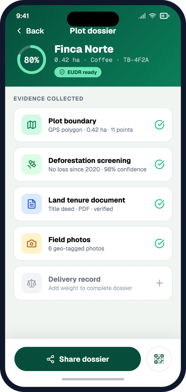
Tracebud's spine is farmer-first field data collection → reusable records → program data readiness. Offline plot mapping, consent, cascading network requests, and reusable EUDR-ready compliance records are meant to sit under multiple moulds: EUDR, RA/Fairtrade-aligned evidence needs, and other programmes such as regenerative agriculture or living income — without inventing a new farm visit each time.
Ops, Network, and Agency shells help different actors work the same records. Delivery vs Cover packs keep "what we share for this programme" distinct from "what we keep as the durable field truth."
We do not claim Tracebud replaces Rainforest Alliance or Fairtrade systems, MultiTrace, Fairtrace, or the EU Information System. A practical approach is to make the field layer once, then mould.
Short checklist
- Field geometry standard meets EUDR and cert-aligned six-decimal / polygon rules.
- One consented plot record feeds cert uploads and DDS packages.
- No second full remap scheduled "for EUDR only" without a gap analysis.
- CoC / IP upgrades planned with the same producer list as mapping.
- Operator still owns DDS and risk assessment — cert data is input, not a substitute.
Learn more about field-first capture and reusable compliance records at tracebud.com.
Sources
- Regulation (EU) 2023/1115 — EUR-Lex: consolidated text
- European Commission FAQ (Version 5, April 2026), esp. §§1.1, 1.4, 1.14; certification role in due diligence: FAQ PDF
- Green Forum — EUDR implementation
- Rainforest Alliance — How RA supports EUDR compliance from farm to retailer
- Rainforest Alliance — Alignment with the EUDR policy
- Fairtrade — Geolocation data requirements under EUDR (PDF)